Environment Canada issues rainfall warnings, special statement for B.C., Alberta
Posted May 30, 2026 1:37 pm.
Last Updated June 1, 2026 8:12 am.
Environment Canada has issued rainfall warnings and a special weather statement for a swath of Alberta and British Columbia.
The weather agency says between 50 millimetres and 100 millimetres of rain is set to pour from Saturday until Wednesday on the eastern side of the province, from Fort McMurray in Alberta’s northeast to Lethbridge in the south.
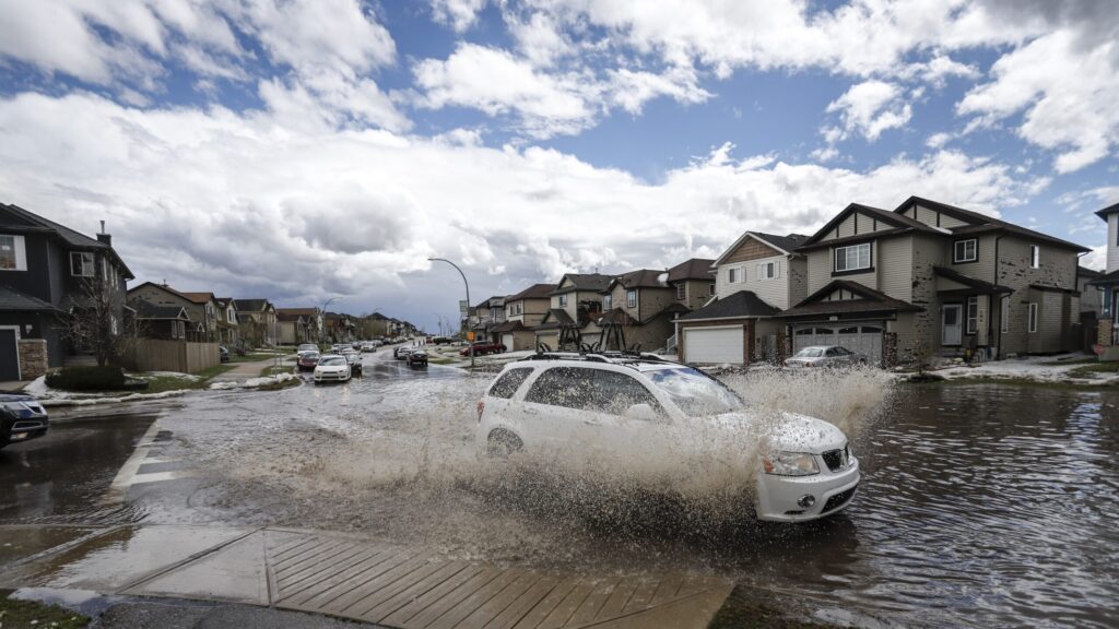
It says water will likely pool on roads and locals should look out for washouts near rivers, creeks and culverts.
On the western side of the province, which includes Banff and Calgary, a special weather statement says 30-60 mm of rainfall is expected.
In B.C., the agency says in a special weather statement that up to 80 mm of rainfall will pour over the roughly next five days in the province’s southeastern Kootenay region.
“A potent Alberta low pressure system will bring moderate to heavy rain to southeastern B.C. this weekend and into early next week,” the Saturday statement said.
“Currently, there is still uncertainty associated with the exact track of this system, and rainfall amounts will vary greatly across southeastern B.C. …There is an elevated risk of flooding, landslides and washouts from heavy rain, and rain on snow in the mountains.”
The B.C. government says in a social media post that multiple communities in the region are under an evacuation alert.
“High water levels can pose a threat to life & safety. Impacted residents must be ready to leave on short notice,” the post said.
A number of rivers in the region as well as in surrounding areas are also under flood warnings and watches.
Back in Alberta, Premier Danielle Smith told her provincewide radio show on Saturday that her government is ready to help communities facing flood risk, which she says isn’t at the same level as it was in 2013.
Thousands of people across southern Alberta had to leave their homes and hundreds of buildings were affected due to significant flooding that year.
Melting snowpack, expected rain prompt flood-prevention measures in Alberta
Meanwhile, communities along Alberta’s Rocky Mountains are preparing for rising waterways from a melting snowpack and forecasted rain.
Lake Louise, Banff, Canmore and Calgary have all posted warnings to residents about brimming rivers expected to flow even higher through the weekend.
Calgary could see as much as 10 centimetres of rain in some areas of the city, said Frank Frigo, the city’s environmental management manager.
“We are anticipating conditions that will trigger high stream flow advisories, but we’re not expecting significant overland flooding,” he said.
“Just the same, we understand that nature is in the driving seat and we’ve learned a lot of lessons since 2013, so we’re approaching the event with caution.”
In 2013, Calgary faced its worst flood since 1897. The city’s website says one person died, and the floods caused as much as $6 billion in damage.
For now, Calgary is only expecting some pathway closures in its low-lying areas and is not considered in a flood watch or warning. The city’s fire department is also advising boats to stay off the water.
Officials say full-sized trees were being pushed along the river, which increases the danger of water use.
There were also some kayakers along the river in Calgary that crews were checking in with to see if they needed help, said Alex Kwan, public information officer for the city’s fire department.
Alberta River Basins has issued flood watches for the Bow River and Pipestone River near Lake Louise and high streamflow advisories for the Bow River near Banff and Canmore.
Lake Louise RCMP and Parks Canada say in a joint statement that many rivers and streams in Banff National Park have more water than normal.
Waterways in the region are facing a sudden accumulation from the wet combination of a high snowpack and warm temperatures.
That combination will be joined by forecasted rain over the weekend, worsening flood conditions in areas where water has already encroached on shorelines.
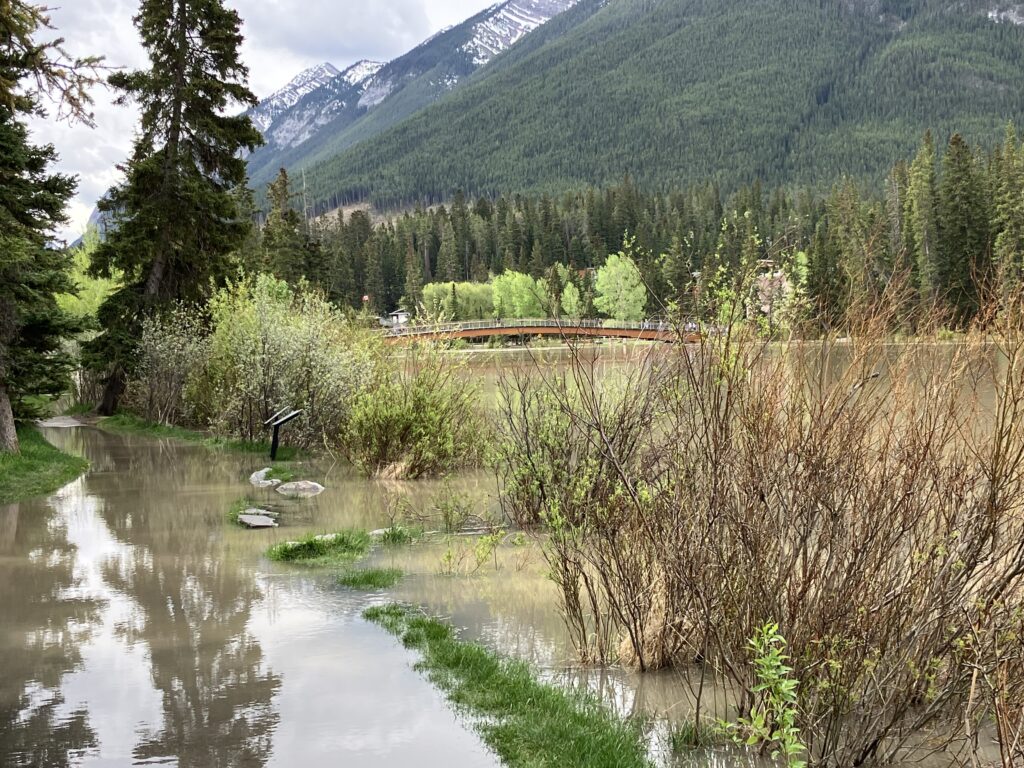
In Banff, crews were setting up temporary flood barriers and are to fill them if they need to dam rising water from the Bow River, which cuts through the town’s south end. Water has already seeped into low-lying paths and trails along the river.
Katherine Severson, the town’s emergency management director, says it has been watching its low-lying areas for a couple of days.
“We know, based on 2013 and other flooding type events, we know what area of the town is at risk,” she said in an interview.
There’s a couple of businesses and residential building complexes that can be protected with the Tiger Dam barrier if needed, she said.
The town is most concerned about letting tourists know about the river risks over the weekend, she said.
East along the Bow River, the Town of Canmore is recommending people stay away from embankments and the fast, frigid water. In a note posted Thursday, the town said the water levels are expected to rise another 30 centimetres through Friday.
“During high streamflow events, water is moving fast, it is extremely cold, and we also see an increase in debris that poses a significant safety risk,” it said.
“We ask that everyone use caution and judgment around the Bow River. Rescues in these conditions are extremely dangerous for first responders.
“Don’t be the reason others are put at risk.”